
This 140 mile drive starts out in Bakersfield and winds through the southern part of the Sierra Nevada mountain range in a backwards "C" shape, ending in the city of Porterville. It takes you from an elevation of about 400 feet on the San Joaquin Valley floor to about 7200 feet in the high Sierras near Ponderosa and back down to the Valley floor. Over the course of the drive you will encounter a wide variety of ecosystems, from the hot, dry San Joaquin Valley to the cool giant sequoia groves of the high Sierra.
The drive starts out in Bakersfield at the intersection of State Routes 99 and 178East/58West (Rosedale Highway). From here, just east of Freeway 99 is Buck Owens Boulevard. Just north of Route 178, Buck Owens Boulevard intersects with Sillect Avenue. Here you will find the BAKERSFIELD archway over Sillect Avenue.

On the southeast corner of the intersection you will find Buck Owens' Crystal Palace. Bakersfield is known for its own honky-tonk style of country music, Bakersfield Sound. Buck Owens, the Buckaroos, and Merle Haggard are products of Bakersfield, and this sound has influenced other country artists, such as Dwight Yoakum and Gary Allan. The Crystal Palace has a museum and performance venue dedicated to this style of music.

A block south of here you will turn left onto Route 178 and cross over the Kern River. This is the first of several crossings of the river on the drive. You then drive through a nice residential area of Bakersfield before the road splits into two one-way streets to cross the northern end of Downtown Bakersfield. Shortly thereafter 178 becomes a freeway and you head across the northeast part of the city. The freeway ends and you continue over the low rolling hills, passing by some nice homes and a country club. The road opens up a bit and you get a good view of the Southern Sierra Nevada ahead of you.

Over a small crest you come down to an area filled with citrus groves. Here on the left is a state historical marker for the Rio de San Felipe. The marker tells about Friar Francisco Garces, the first European to explore the area, in 1776, seeking a better route from Sonora in New Spain to the new settlement in Monterey.

You will pass through the citrus groves as you approach the entrance to the Kern River Canyon.


From here the road is very narrow and twisty up through the Kern River Canyon. Along this part of the drive, look for a wide variety of types of trees growing along the riverbank, from palms and yucca to sycamores, oak, and pine. The canyon is also home to many hydroelectric projects providing power to both Southern California Edison and Pacific Gas & Electricity. It is also popular for white-water rafting and you will see signs encouraging safety all along the drive.


As you enter the canyon, you are also entering the Sequoia National Forest. There are not a lot of places to pull over to check out the river in the canyon, but you will be driving slowly enough to be able to enjoy the views. There are a few Forest Service picnic grounds where you can pull off and make your way down to the water's edge, such as here at the Live Oak Picnic Grounds:

You'll drive for several miles through the twists and turns of the canyon. The canyon then widens, as does the road, with two lanes for uphill drivers for a while and then "freeway" with four lanes all the way to Lake Isabella. As you approach the first exit for the town of Lake Isabella, the canyon opens up to the Kern River Valley. The lower part of the valley still has some open space but the middle part is now the reservoir, Lake Isabella.
Take the second Lake Isabella exit, State Route 155. You can turn right and go into the town of Lake Isabella for fast food, groceries, or gasoline. Turn left towards Kernville to continue the drive. After about a mile, you can turn right and head up to the Lake Isabella Ranger Station. Here you will find some exhibits and information about the lake and the surrounding area. You will have a great view across the reservoir from here:

Return to Route 155 and drive along the western shore of Lake Isabella. After a few miles, you'll enter the town of Wofford Heights. Route 155 makes a left turn here, but you will continue ahead on Wofford Boulevard which becomes Burlando Road, taking you to the town of Kernville.
Kernville was originally called Whiskey Flat and was located in an area now covered by Lake Isabella. It was formed during a small gold rush in the area in 1848. When Isabella Dam's construction began in 1948, the entire town was moved upstream to its present location. You can still see remnants of the original town just east of Wofford Heights when the water level of Lake Isabella is low.
Kernville maintains its gold rush and old west roots in its style. You can visit the Kern Valley Museum (which was unfortunately closed when I was there), explore antique shops and other stores, or picnic in Riverside Park. It is also home to many sports shops, supporting the wide variety of outdoor activities to be done in the area, such as white-water rafting, kayaking, mountain and rock climbing, camping, and hiking. There is parking around the park in the center of town or along the frontage road on the south side of the main street of town.

The museum is open Thursday-Sunday from 10:00 AM to 4:00 PM.


The Kern River at Riverside Park.

The Kern River Inn facing Riverside Park.

I had lunch at Cheryl's Diner, a friendly-staffed restaurant on the south side of the main street. I had one of the best hamburgers, a bleu cheese burger with French fried onions on it, for lunch here. The story about the restaurant on the backside of the menu is interesting, about how the woman who owns the restaurant got started and how her husband is involved in it. Stop in for a great meal, friendly service, and a cute story!


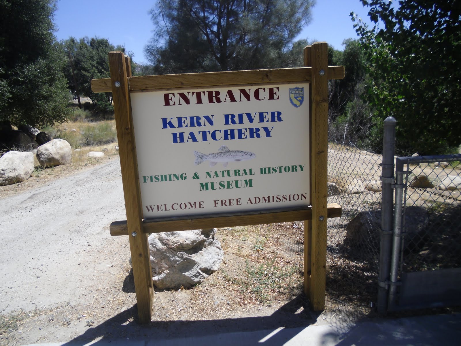
Leaving the main part of Kernville, you cross the river and come to a T in the road. Turn left onto Sierra Way. You are now heading up the North Fork Kern River Canyon. After about a mile, the Kern River Fish Hatchery will be on the left. It is always open to explore and they have a small museum that is open on weekends. The Kern River is known for its Golden Trout and the hatchery helps maintain that population. Take some quarters with you, as you can buy food and feed the trout in the various large concrete tanks. I also saw a deer wandering around the grounds.


Back to the road, you will be driving north along the North Fork of the Kern River. There are many private and Forest Service campgrounds and some picnic grounds where you can park and get out and down to the water's edge. After several miles you will cross the Johnsondale bridge. There is a parking area here and it is a nice place to stop to check out the river.


At this point, you are entering the Giant Sequoia National Monument. It was created by President Bill Clinton on April 15, 2000, to protect the 33 Giant Sequoia groves in the National Forest.


Keep your eyes open for deer along the side of the road.
From here, the road climbs and leaves the edge of the river. Before long you are leaving the scrubby brush, chapparal, and scrawny trees of the lower Sierra and enter the denser forest of the high Sierra. There is a store at Johnsondale, a small, private community also known as R-Ranch in the Sequoias. I stopped here for a bottle of cool water.

Looking out across the North Fork Kern River watershed.

Looking down across Johnsondale.
The forest continues to get denser and the temperature continues to drop. It was 95 degrees when I was in Kernville and soon the temperature is 73 degrees. You will come to a stop sign and turn right onto the Western Divide Highway. This road is fairly flat and straight and is in good condition. Roll down the windows and enjoy the cool, mountain air. Off to the right side are occasional glimpses across the upper part of the Kern River basin.
After a couple of miles, you will reach the parking area for the Trail of 100 Giants. A volunteer was there collecting the $5.00 parking fee and to answer any questions you might have. She provided me with a brochure about this terrific walk through the Long Meadow Grove of Giant Sequoias. It is paved and wheelchair accessible, about a 1.3 mile walk. Restrooms are also available here.


Continuing on the Western Divide Highway, you will reach the small community of Ponderosa. There is a store here and you have reached an elevation of over 7200 feet. Shortly after Ponderosa, the road becomes State Route 190 and you begin your decent back down to the San Joaquin Valley. The road again becomes quite twisty as you snake your way down along two forks of the Tule River to Springville. There are a few places to pull over and enjoy the view, including one next to a waterfall.


At about 1000 feet in elevation is Springville, well known for its rodeo. Nearby is Eagle Mountain Casino, operated by the Tule River Indian Tribe. You continue past Lake Success and will reach Porterville and Highway 65. You can return to Bakersfield south on Route 65 or continue ahead on Route 190 to reach Highway 99 at Tipton.
No comments:
Post a Comment